|
Walks in The Lake District |


|
|
Walks in The Lake District |
A circular walk from Ambleside in the Lake District. The walk heads out of Ambleside through Skelgyhll Wood to the viewpoint at Jenkin's Crag. The walk then heads on up Hundreds Lane and on to climb Wansfell. From here to the west can be seen the Langdales (Bow Fell, Crinkle Crags and the Pike of Blisco), to the North there is the Kirkstone Pass and Fairfield Horseshoe, to the East is High Street and Windermere to the South. The walk then drops back down into Ambleside.
|
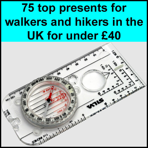
Best gifts for walkers - 49 top presents for hikers under £35 If you are wondering what to buy someone who likes walking, or searching for those inexpensive or personalised gifts for hikers, then look no further. We've put together a selection of practical presents under £35 that any walker or hiker in the UK would like to receive. Read our article: Best gifts for walkers - 49 top presents for hikers under £35 |

|
What to wear and take on your walk If you are new to walking and want to know what to wear and take on your walk, or just want to know what to consider when buying your walking clothes and equipment then these articles are for you. We'll also take you through our favourite walking boots, walking jackets, walking trousers, rucksacks, backpacks, water bottles, mapping and safety equipment etc. of 2026. Read our articles: What to wear on a walk and What to take on a walk |
| Parking: | Long stay car park on A591 entering Ambleside from Windermere, just past Hayes garden centre (grid reference NY 377 038). |
| Directions: | Google Maps: get directions here / What3words: purified.trees.including |
| Walk distance: | 5.3 miles (8.4 Km) |
| Estimated walk time: | 2 hours 40 minutes |
| Height climbed: | 490 metres |
| Grade: | 2-C: A medium length walk that has rugged terrain and some steep climbs |
| Peaks / summits: | Wansfell |
| Wainwrights: | None |
| Map: | Ordnance Survey - Explorer OL7 (The English Lakes - South-eastern Area) Buy this map from Ordnance Survey |
| Walk features: | Birds, Flowers, Hills or Fells, Pubs, Views, Wildlife |
| Facilities / refreshments: | Many pubs and cafés in Ambleside |
| Nearest town: | Walk starts in Ambleside |
| Local self-catering accommodation: | View self-catering accommodation close to the start of this walk |
| Local hotels, inns and B&Bs: | View hotels and inns close to the start of this walk from The Inn Collection Group |
| Walk Tags: | Ambleside, Skelghyll Wood, Jenkin's Crag, Wansfell, Wansfell Pike, Hundreds Road, Windermere, Wainwright walk, Lake District, lake district walk, lake district national park |

View from the lane over to Windermere
Leave the back of the car park (opposite side to the A591) and turn right heading away from the centre of Ambleside onto a narrow lane (Old Lake Road). After about a hundred yards, take the lane off uphill to the left, at the White Lane Foot cottage, which is signed for Jenkins Crag - Skelghyll and Troutbeck (bridleway). The walled lane winds quite steeply uphill and views of Windermere soon start to open up over the wall to the right, with the start of Fairfield Horseshoe over to the left. As the lane splits, take the right-hand fork signed "Broad Ings, Skelghyll Wood and Jenkin's Crag". As progression is made down the lane, more and more of Windermere comes into view with the commanding Langdales in the distance beyond.
Again take the right-hand fork at the next split in the lane signed "Skelghyll Woods" ignoring the private driveway which heads off uphill to Broad Ings. Shortly after the split in the road, the metalled road turns into a gravelled track as it enters Skelghyll Woods. Do not enter Skelghyll Woods itself where a small path leads off to the right by a sign, but keep heading upwards on the main path. About fifty yards further on as the path again splits, take the right-hand fork which heads up the right-hand side of a wall. Then at the next split in the path take the left-hand fork following the National Trust sign for Jenkin's Crag and Troutbeck.
The path now becomes rockier underfoot and swings around to the left as it starts to climb the left bank of the stream. The path swings right over a stone bridge to cross the stream before heading off uphill meandering its way between the trees. As the path starts to flatten, it pulls in alongside a wall. Continue ahead ignoring the National Trust sign for Kelsick Scar and shortly on the right-hand side of the wall there is a gap through which can be found the signed viewpoint of Jenkin's Crag.

View from Jenkin's Crag
After admiring the beautiful panoramic view from Jenkin's Crag, return back to the main path and continuing on in the same direction, the path soon leaves the tree cover. Shortly after leaving the woods, there is an excellently positioned bench to take a five-minute break and admire the view down most of the length of Windermere. Continue on the path, pass through a wooden gate and head onwards towards thigh Skelghyll farm. Pass through another wooden gate, on which there is a green National Trust bridleway sign, cross to the opposite corner of the farmyard, and exit through a further wooden gate.

Path entering the farm

Path leaving the farm with the way ahead visible on the hillside opposite

View back to the farm, Windermere and the Langdales beyond
Leave the farm heading down the lane and immediately upon crossing the cattle grid and the stream, go through the kissing gate on the left, which is closely followed by a further wooden gate, from where the path rises steadily on the grassy hillside. As the path starts to flatten, it passes the remains of a barn, before bending around to the right as it crosses a small stream and then pulling in alongside a wall. Continue along the path passing through another wooden gate, before passing through a wooden kissing gate onto Robin's Lane which leads down into Troutbeck. Immediately on reaching this lane turn left, not following the Troutbeck sign, pass through a wooden gate, and start to head up the track (Hundreds Road), which sets off in the direction of Wansfell.
This walk can be extended by turning right here, following Robin's Lane down into Troutbeck, turning left onto the road through Troutbeck, then taking another left at the Wansfell sign up Nanny Lane passing through Lane Foot Farm. The entrance to this Lane is quite well hidden. Nanny Lane is then followed for about three-quarters of a mile before turning left over the wall at a sign for Wansfell, where after a further one hundred and fifty yards the original route of the walk is rejoined by a metal kissing gate.

View up Hundreds Road to Wansfell summit

Sheep on the footpath where it leaves the track just before the bridge

A horse fore-shortening the summit of Wansfell
Follow the track (Hundreds Road) for about three-quarters of a mile during which time a wooden gate is passed through. Go through a second wooden gate where the track ahead bends around to the left before passing over a picturesque stone bridge over a stream. Just before the stream take the path which leads off up the grassy banking on the right, and is signed by the National Trust as a permitted path to Wansfell and Nanny Lane. Head up the first field following the path which is marked by one foot high wooden stakes with white arrows on. The view behind from here now affords the full length of Windermere. Pass through the gate at the top of the field and continue following the wooden markers across the next field. Off to the left can be seen the summit of Wansfell. As this field is crossed, the northernmost side of the Kentmere Horseshoe starts to come into view over to the right with Ill Bell prominent directly ahead.

View through the kissing gate to the summit of Wansfell
The path pulls in alongside a wall, at a point where the wall bends sharply to the left. Follow the path for a further one hundred yards before turning left through a metal kissing gate in the wall. This is where the path from Nanny Lane (see extension to the walk above) comes in from the right. The path from here is now clearly visible stretching ahead to the summit on the horizon. As the path reaches the summit, it meets a wall / fence coming in from the right-hand side. From here to the west can be seen the Langdales (Bow Fell, Crinkle Crags and the Pike of Blisco), to the North there is the Kirkstone Pass and Fairfield Horseshoe, to the East is High Street and Windermere to the South.

View from the summit - Ambleside, Rydal and the hills beyond

View from the summit - Kirkstone Pass

View from the summit - Northern leg of the 'Kentmere Horeshoe'

View from the summit - Windermere

The path back down into Ambleside
Go over a wooden stile in the fence (on the back of which is "Public footpath to Troutbeck via Nanny Lane - follow cairns", then turn left heading steeply down hill for about fifty yards before pulling in back near the wall by a further wooden stile. Ignore this stile, and turn right at a pile of stones heading directly away from the wall following the path which shortly afterwards becomes very obvious. The majority of the early part of the steep descent is via man made steps in the hillside.

Wooden footbridge with Ambleside in the distance

The view back up to Wansfell from the stile
The path passes through a gap in the wall and continues heading down towards Ambleside below. It continues down the rocky path, passing over a wooden footbridge by some trees, before continuing its descent. The path eventually pulls in alongside a stream before meeting a wall where it starts to flatten. Pass through the wooden kissing gate at the corner of the wall and head down the gravel path adjoined by a wooden / wire fence erected to stop short cuts across the field. Follow the path until it meets a stile over which there is a three step drop onto a lane. Looking back from the stile, Wansfell in all its glory can now be seen.

The view from the bench
Turn left onto the road passing another beautifully sited bench which affords views over towards the Langdales. Wandering down this lane, the water of Stock Ghyll can soon be heard. A short diversion can be made a few hundred yards down the lane, by turning off to the right, passing through a kissing gate and walking the short distance to view Stockghyll Force. Return to the lane and continue on down into Ambleside, branching left as the lane splits at the public toilets, then turning left a few yards further when the lane meets the main A591. The A591 can then be followed for about half a mile where the car park is reached on the left. An alternative to keeping on the main road is to turn left after a few hundred yards on the main road, onto Old Lake Road, which is then followed for about one third of a mile, before reaching the car park which is on the right.
Click here for Disclaimer